-
Last edited by Furtho; 12-07-2017, 07:57. -
Future solar eclipses, mapped
None in the UK in my lifetime, alas, but it looks like we should be booking 2026 holidays in Bilbao now.Comment
-
The old British ordnance maps play a role in New York 2140. There's a subplot about kids trying to find the gold that went down with the HMS Hussar, now possibly buried under a bit of the Bronx.Originally posted by MiserableOldGit View Post
https://en.wikipedia.org/wiki/HMS_Hussar_(1763)Comment
-
Originally posted by Ginger Yellow View Post
Good stuff. Perhaps getting hammered somewhere near Mendoza in 2019 would be fun...Comment
-
Great Britain, maps, statistics and train stations. If this doesn't get BB&F back, nothing will http://www.citymetric.com/transport/...n-station-3165Comment
-
Map indicating the location of Hard-To-Find Farm, Buckinghamshire.
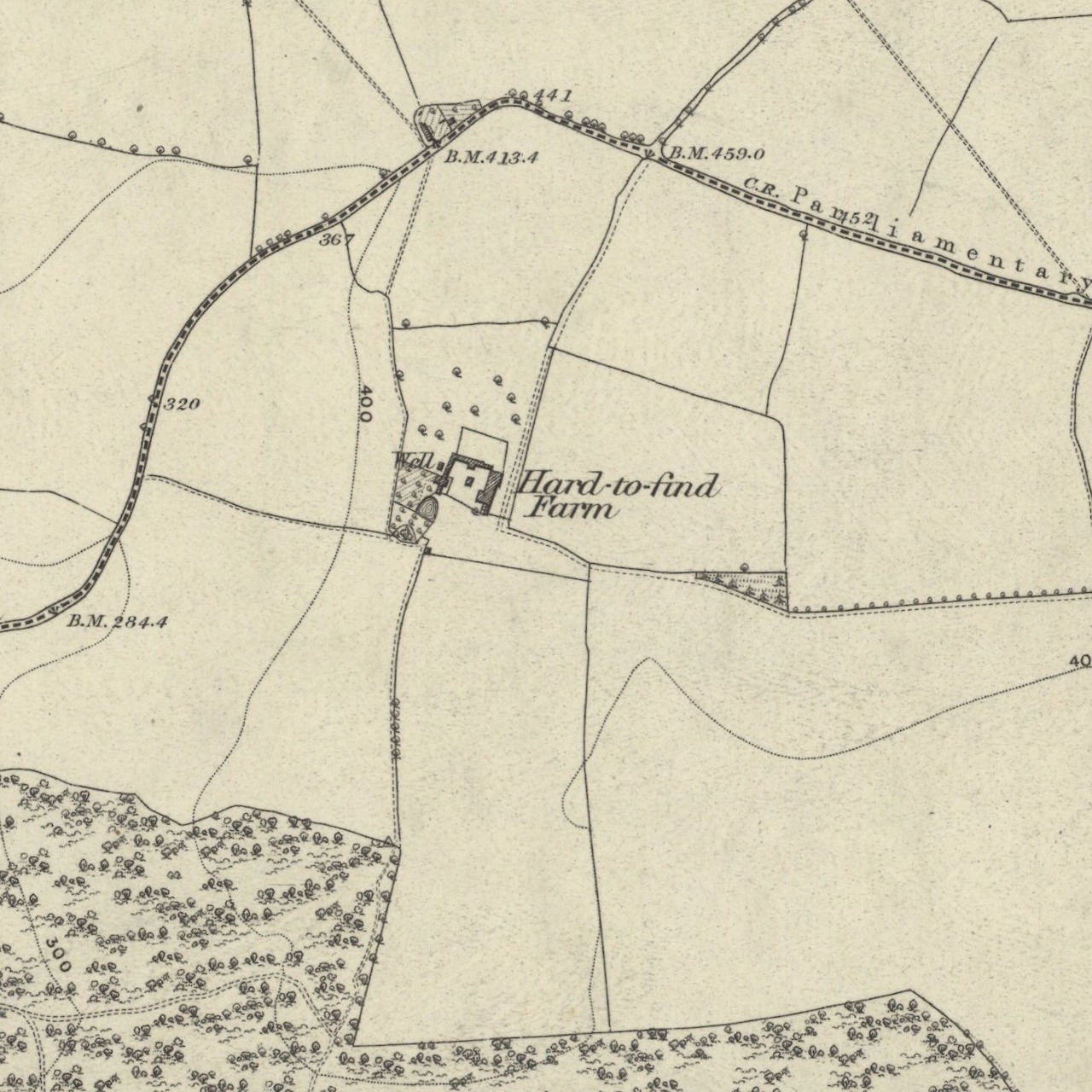
Comment
-
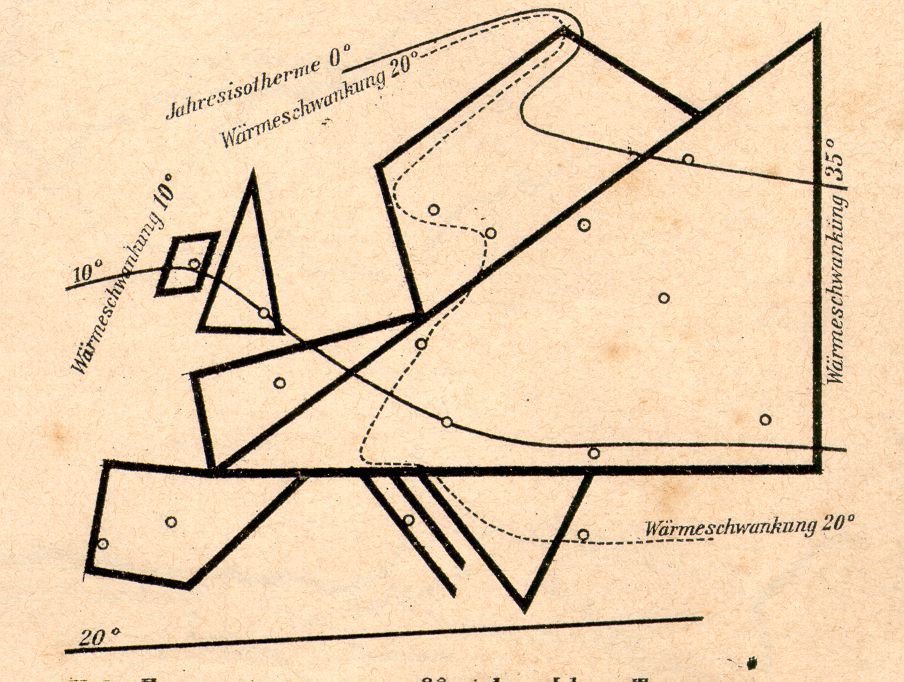
Couple of nice stylised maps.
Emil Letoschek’s weather map, produced in Vienna, 1888.
Map showing domestic flights in East Germany.

Comment
-
-Comment
-
I never knew that Interflug had domestic routes within the DDR.
None of those routes exist today, and Barth, Chemnitz (ex Karl Marx Stadt) and Eisenach have no scheduled service.Comment
-
Originally posted by Ginger Yellow View PostFantastic, that. It looks a tad far north for Mendoza, though (is there a way to zoom in?). But it does look very like it's going to end right over Buenos Aires, so if anyone wants to come down for it I assure you it's very easy to get hammered here too (and I'll be happy to help you do so). Mendoza's fucking freezing at this time of year anyway.Originally posted by San Bernardhinault View Post
I am obviously rather chuffed to discover this.Comment
-
Ah, the animation on Wikipedia makes it looks like the line of totality might actually be over Buenos Aires just after sunset, in fact. Bugger! I wonder if it'll be visible at 100% from Rosario. Got a couple of friends there ...Comment
-
Another East German map, this time in the context of a perceived attempt by the US to sabotage the country's agriculture through the introduction of the Colorado beetle.
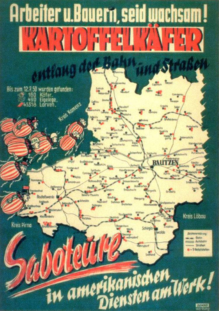
Comment
-
Comment
-
Holy moly. Interested in old Ordnance Survey maps of England? Intrigued by the idea of wasting a gigantic amount of time faffing happily around on the internet? Step this way...Comment
-
I see that in the 1920s, Ordnance Survey decided to rename Boston Castle as Beston Castle...Comment
-
Looks like you're right about Mendoza. And it's just south of BA, at sunset. By the look of things, you'll probably want to drive a few miles south and west (presumably further from the coast is going to have less risk of clouds, too).Originally posted by Sam View Post
https://eclipse.gsfc.nasa.gov/SEgoog...02Tgoogle.htmlComment
-
Ah, passing right over some of the less pleasant bits of Greater Buenos Aires, at a time of day when traffic is going to be a nightmare. Maybe I can talk my girlfriend into taking the day off work and we can drive out to Chacabuco or Jun�n or something.Comment
-
Map showing by English county the proportion of 1851 parish names that refer directly to water. Larger version is here.

Comment
-
Another map of East Germany, this time on the cover of the GDR's English-language propaganda newsletter Democratic German Report, 1962.

Comment
-
West, shurely...
An interesting piece of history though. I wonder what happened to those top, top Hitler officers?Comment
-
Duh, yes. I shall leave it there as a monument to, etc. etc.Comment
-
Map produced by Poles and published in Rome "documenting, though likely with some exaggeration, the extent of the Soviet gulag system", 1945. More information here.

Comment
-
-
Morningtinium Crescentum!Comment
-
Oh man. That's the day gone and the report will have to write itself.Originally posted by Furtho View PostComment

- If you are currently locked out of OTF due to not being able to remember/reset your password, password reset emails are now working.


Comment